A satellite’s altitude starts at the surface
A building’s height starts at the ground, not Earth’s centre. Satellite altitude works the same way. To measure from Earth’s centre, add the length from centre to surface.
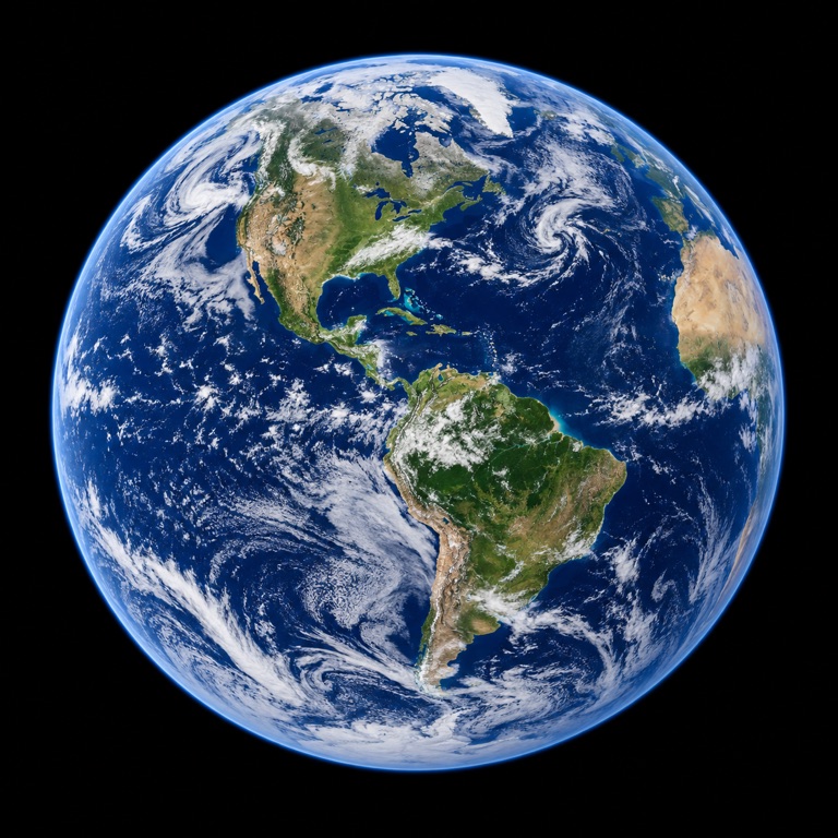
Work it out, one step at a time
Choose the two connected lengths
R = 6,371 km; h = 35,786 km
This teaching example uses a mean spherical Earth and a representative geostationary altitude.
Add them
6,371 + 35,786 = 42,157 km
The result starts at the centre. It is not the altitude or the distance around the orbit.
Words made simple
- Geostationary
- An equatorial circular orbit that matches Earth’s rotation, so the satellite appears fixed from the ground.
Think about it: A satellite is 500 km above the surface. What is its distance from the model Earth’s centre?
6,371 + 500 = 6,871 km. Marking the starting point prevents mixing the two distances.
Where the numbers come from: NASA JPL · ESA. The illustration and worked model are made for this lesson; assumptions are stated above.
Go further: definitions, formulas and a second example
The number 35,786 km commonly appears beside a geostationary satellite. It describes altitude above the equator, not distance from Earth’s centre. Keeping the starting point visible prevents several large errors in a scale comparison.
Mark the origin of the measurement
Altitude begins at a reference surface. Orbital radius begins at the centre of the gravitating body. In a spherical model the conversion is r = R + h. It is an addition, not a unit conversion: both terms are already lengths in the same unit, but they refer to consecutive parts of a line.
For a deliberately rounded example, combine h = 35,786 km with the chosen mean-sphere R = 6,371 km. The resulting model radius is 42,157 km. An actual equatorial-orbit calculation uses an appropriate equatorial reference and orbital parameters; this simple sum is labelled as a teaching model rather than a precision GEO solution.
Going around is longer than going outward
The circular path length is 2πr, not the altitude multiplied by 2π. In the rounded example it is approximately 264,900 km. That distance concerns a complete model orbit. It is neither a launch trajectory nor the instantaneous line-of-sight distance from an arbitrary ground station.
A ground station away from the point beneath the satellite sees a slanted path through space. That geometry is why “signal delay from GEO altitude” is only a simplified lower-level example. A communication calculation also needs the station location and whether one hop, a relay or a return path is being counted.
Stationary describes a viewpoint
ESA explains that geostationary satellites match Earth’s rotation over the equator. They appear near a fixed point in the sky for an observer on the rotating surface. They still move in an Earth-centred frame, so a diagram that shows no sideways motion is describing a reference frame rather than a motionless satellite.
A circular orbit, the equatorial plane and the correct period work together to create that behaviour. Matching a period alone does not automatically produce a fixed point for a ground observer. Distinguishing geosynchronous from geostationary is therefore a question of orbit geometry, not just of a convenient altitude label.
Draw three arrows instead of one number
On a circle, draw a radius to the ground, an altitude from ground to satellite, and a centre-to-satellite arrow. Then draw the circular path separately. Writing R, h, r and 2πr beside them exposes exactly which quantity a ratio uses.
Use the existing geostationary page to compare the stated altitude, and the Earth-radius page for the starting reference. A useful explanation is one that allows the reader to reproduce the sum while also knowing why a professional orbit calculation requires more information.
Reproduce one result
Calculate this result using the definitions and assumptions in the article.
- Expression
- 6,371 + 35,786
- Calculated result
- 42,157 km
Check the numbers and their sources
Open a source to see what it supports. The picture is our explanation; the original evidence is linked below. These AI-assisted explanations have automated calculation checks, but no expert peer review.
ESA — Types of orbits
GEO altitude is above the equator; the spherical worked example uses an explicitly chosen mean radius. Source record checked:
Read the original sourceNASA JPL — Planetary Physical Parameters
Equivalent-volume spheres; topography and flattening omitted. Previous NSSDC URL redirects to a status page. Source record checked:
Read the original source