Follow a narrow borehole beyond humanity’s reach, through solid rock that changes structure, into the liquid metal that powers our magnetic field. An illustrated journey, not underground footage.
Prototype: surface to the human drilling record, 12.26 km. The complete eight-chapter journey remains available below.
Magnified soil-life illustration
Depth and size do not indicate a real habitat location.
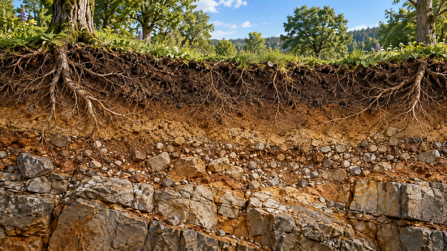
The world beneath your feet is alive. Roots and organisms occupy soils whose thickness and composition vary with climate and geology.
State and model values
Physical state
Soil and weathered rock
Major composition
Roots, mineral grains, water
Pressure · PREM-derived
≈ 0 GPa
Density · PREM
≈ 1.02 g/cm³
Gravity · spherical model
≈ 9.82 m/s²
Temperature
No verified continuous thermal profile
Numbers use a spherical PREM reference, including its ocean surface layer, not this local continental illustration. Boundaries and colours are illustrative.
Approximately 12.26 km. Earth’s center is 6,371 km below the surface.
Forsterite / olivineLaboratory reference unit cell · not the full atomic arrangementCell dimensions source
You have reached Earth’s center.
6,371 km below the surface. No spacecraft, tunnel or human can make this trip: our guide is seismic evidence and physical models.
PREM does not provide a temperature curve. The pure-iron melting estimate of 6,230 ± 500 K at 330 GPa is an extrapolation from laboratory experiments near inner-core-boundary conditions, not a measurement of Earth’s center or an alloy temperature. No unverified central temperature is displayed.
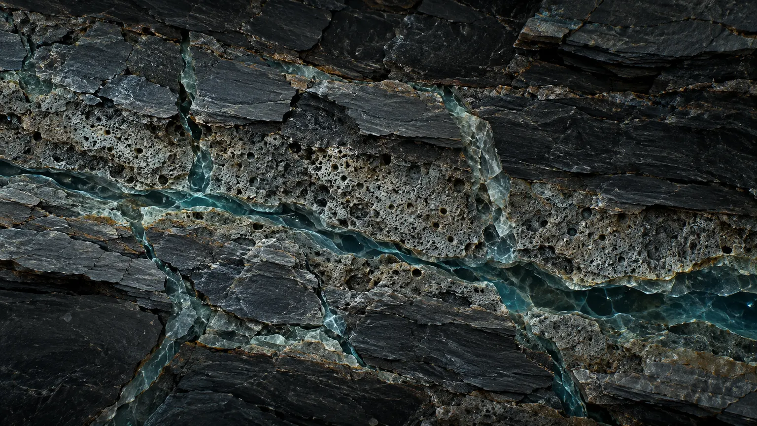
Sunlight disappears. Groundwater can occupy connected pores and fractures, not just caves. This is an illustrative continental profile, not a universal aquifer depth.
Deep microbial ecosystems depend on temperature, water, chemistry and energy. There is no established universal depth at which all life ends. The magnified artwork is not evidence of life throughout this interval.
Beyond the deepest borehole, our evidence becomes indirect. The Moho varies between oceanic and continental crust. Lithosphere includes crust and rigid upper mantle; the asthenosphere deforms slowly over geological time.
Pressure reorganizes mineral structures near 410 and 660 km. Near 520 km, wadsleyite can transform to ringwoodite; that seismic feature is weaker and less uniform. This chapter spans upper, transition-zone and lower mantle: it is not itself a geological layer.
Physical state: Solid high-pressure mineral phases
Below the transition zone, compressed silicate minerals dominate. Heat does not mean a global lava ocean. Mantle material can flow slowly while remaining mostly solid.
Near 2,890 km, solid silicate gives way to liquid metal. Motion of electrically conductive outer-core fluid sustains the geodynamo. Field lines in the navigator are a simplified illustration, not visible threads in the metal.
Near 5,150 km the inner core is solid: extreme pressure raises the melting threshold. Its precise crystal structure and thermal profile remain uncertain. At the exact center, net gravity is zero in a spherical model; humans cannot visit this environment.
Kola reached 12,262 m in a narrow borehole, roughly 23 cm across—not a human-sized tunnel. Its vertical depth is distinct from the length of a directional well.
Humanity’s deepest drilling achievement
Approximately 12.26 km. Earth’s center is 6,371 km below the surface.
Only about 0.192% of the surface-to-center distance. Marker symbols are enlarged for visibility; the depth segment is drawn to scale.
Microbes in deep mines and boreholes can use chemical energy. Habitable conditions depend on local heat, liquid water and available reactants. A story stop at 5 km is not a universal biological cutoff.
Increasing pressure favors denser mineral structures. In the Mg₂SiO₄ system, olivine changes to wadsleyite, then ringwoodite. Near 660 km, ringwoodite breaks down into bridgmanite and ferropericlase. The SVG below compares published atomic sites of two laboratory samples, not a full crystal or a literal transformation path.
Same basic chemistry. Different crystal structure.
Mg₂SiO₄ · Olivine → wadsleyite → ringwoodite
≈ 410 km · ≈ 520 km · ≈ 660 km
Anhydrous Fo100, Table 2
Oblique projection of fractional coordinates x/a, y/b, z/c (0–1); asymmetric sites only. Not a complete crystal, and not observations at depth. Axis lengths are normalized. Colours identify Mg, Si and O; circle size is not atomic radius.
Hydrogen can be bound as hydroxyl in transition-zone minerals. A hydrous ringwoodite inclusion in a diamond supports a locally water-bearing transition zone. Storage capacity is not a measured global inventory; this is not a free-flowing underground ocean.
Thermal and compositional buoyancy drive electrically conducting liquid in the outer core. Induction and electric currents sustain the geodynamo. The inset shows an idealized dipole, not a literal photograph or a simulation of the full dynamo.
Phase depends on pressure as well as temperature and composition. Extreme pressure makes a solid iron-rich inner core possible next to a liquid outer core. No single iron crystal arrangement or whole-Earth thermal curve is asserted here.
No. In the spherical PREM-based calculation, gravity initially rises with depth and is about 10.7 m/s² near the core–mantle boundary. At the exact center, contributions cancel and net gravity is zero. This ignores rotation and local anomalies.
Depth axis is linear here, unlike the cinematic timeline. Pressure in GPa; gravity in m/s². Gravity first rises, then falls to zero at the spherical center.
Seismic observations and high-pressure experiments constrain the interior; no camera has photographed the mantle or core. Atmospheric colours, metal motion and scale-amplified microbes are conceptual. Crystal diagrams show published asymmetric atomic sites, not a full symmetry-expanded unit cell or a movie of atoms at depth.
Density comes from the piecewise PREM model. Pressure is calculated by integrating density × gravity through a spherical, non-rotating Earth. Density jumps are preserved. Rounded display values are estimates, not local measurements.
PREM does not provide a temperature curve. The pure-iron melting estimate of 6,230 ± 500 K at 330 GPa is an extrapolation from laboratory experiments near inner-core-boundary conditions, not a measurement of Earth’s center or an alloy temperature. No unverified central temperature is displayed.
How pressure and gravity change with depth
Depth axis is linear here, unlike the cinematic timeline. Pressure in GPa; gravity in m/s². Gravity first rises, then falls to zero at the spherical center.
Why seismic waves reveal a liquid core
P waves can travel through solids and liquids; S waves do not propagate through the liquid outer core. Paths here show that distinction only, not ray-traced travel times or shadow-zone angles.
Five questions from the descent
Optional, anonymous and entirely in your browser. Every answer includes an explanation.