Shallow water. Powerful currents.
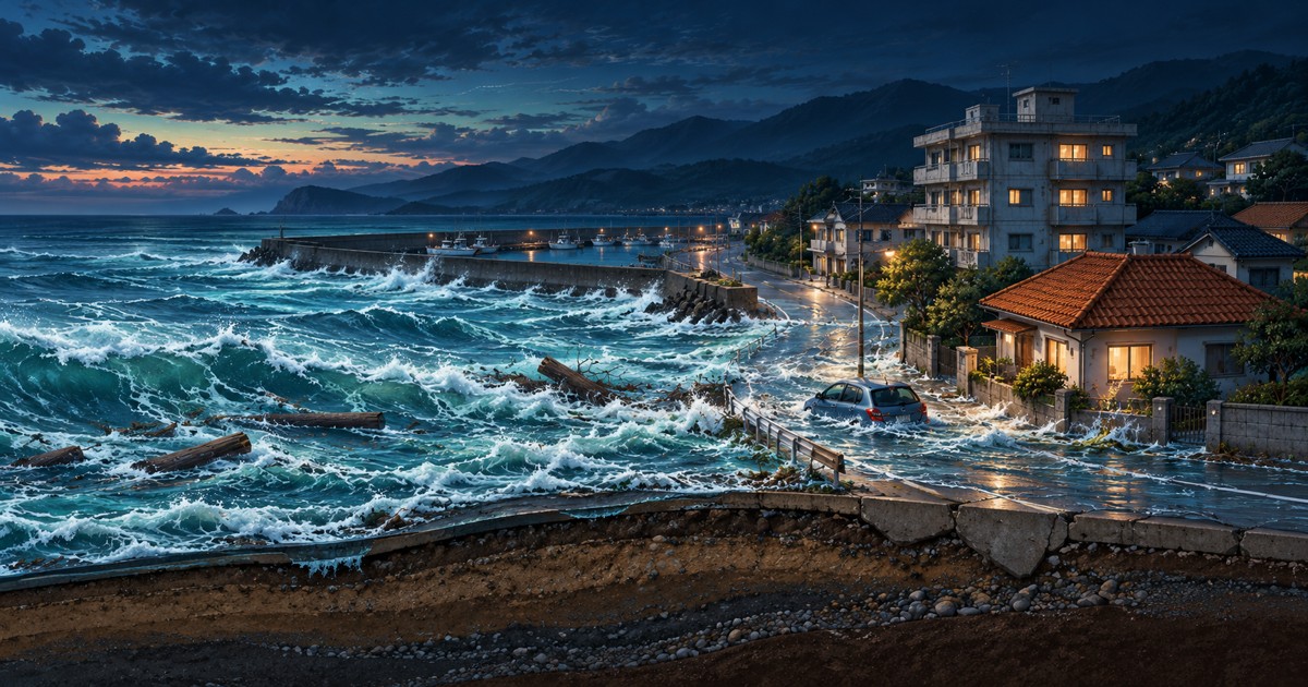
Water reaches the lower part of a car. Even a modest depth can carry debris into objects and buildings.
Japan Meteorological Agency · Tsunami questions · NOAA / National Weather Service · About tsunamis
Travel through scale.
A ScaleTrip science chapter
A car. A house. A whole water column. Stay in the same scene and watch the scale change.
Start with what the height means2011 TOHOKU · FROM CAUSE TO LESSON
From moving plates beneath the sea to the loss of cooling at Fukushima. Pause across 12 scenes and follow each cause and consequence.
Loading the scenes. The full illustrated transcript below is already available.
HISTORICAL EVENT · JAPAN STANDARD TIME2011.03.11 · JAPAN
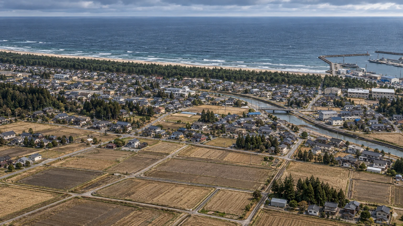
On 11 March 2011, a huge earthquake struck off northeastern Japan. Follow the links from movement beneath the sea to inundation on land, and then to the loss of cooling at Fukushima Daiichi.
The 128-second running time is authored for teaching; the actual events unfolded over minutes to days. Coast and plant images are generated illustrations. Flood boundaries, debris paths and reactor cutaways are conceptual, rather than exact geography or an engineering simulation.
A silent educational film with on-screen explanations. Full-screen viewing is available.
Download film · Informed by JMA, USGS, IAEA and NRC sources
2011.03.11 · JAPAN
On 11 March 2011, a huge earthquake struck off northeastern Japan. Follow the links from movement beneath the sea to inundation on land, and then to the loss of cooling at Fukushima Daiichi.
Look for the cause first, then the function that failed.
BEFORE · 2011.03.11
Earth’s outer shell is divided into moving plates. At the Japan Trench, the Pacific Plate descends beneath the plate carrying Japan. Friction can hold part of that boundary while the surrounding rock slowly deforms.
Think of a ruler held bent in your hands. Rock also stores energy as it deforms.
2011.03.11 · 14:46 JST
A large slip on the plate boundary caused the earthquake. Rapid vertical movement of the seabed displaced the water above it, sending long waves outward. JMA reports magnitude 9.0; USGS reports 9.1 using its assessment.
Imagine lifting a broad part of a bathtub floor. The water above it must move too.
2011.03.11 · 14:46 → 14:49 JST
Units 1–3 shut down after the earthquake. Emergency diesels started when off-site power failed. Radioactive decay in the fuel continued producing heat. JMA issued its first tsunami warning at 14:49.
Switching off a stove does not instantly cool the pan. A reactor also continues generating decay heat after shutdown.
2011.03.11 · WAVES TRAVEL
A tsunami differs from a short wind wave. A very long disturbance travels across the ocean. In shallower water its propagation slows, while local depth and coastal shape alter wave height and flow.
Picture a long body of water advancing, rather than a single thin breaking wave.
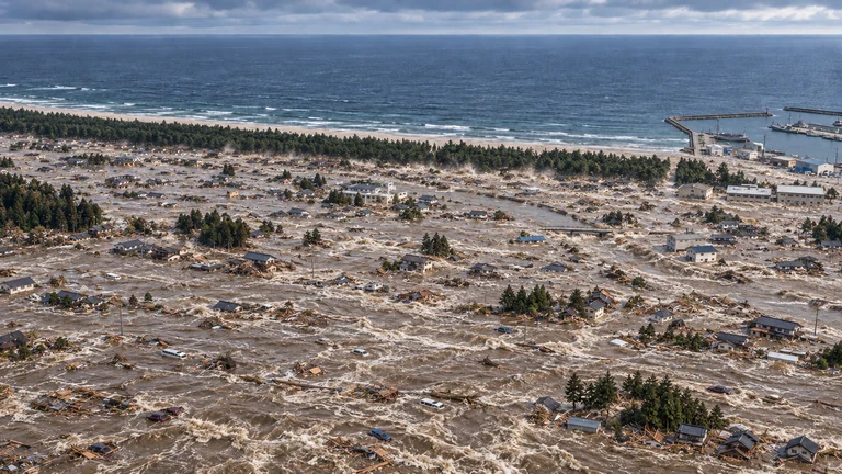
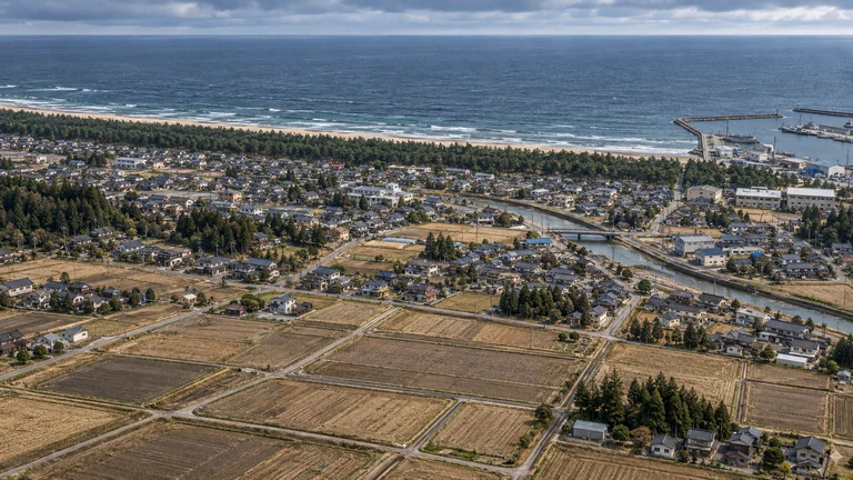
2011.03.11 · COASTAL INUNDATION
After overtopping the coast, water spreads across low terrain. In one surveyed part of the Sendai Plain, it reached about 4.5 km inland. That is a horizontal distance, not the depth of the water.
About 45 lengths of a 100 m school field. This observation belongs to a surveyed area; the pictured coast is fictional.
2011.03.11 · FLOW AND RETURN
Depth alone does not determine damage. Flow pushes and lifts objects; trees, vehicles and building debris can strike other structures. Returning water also carries debris away. Later waves may be larger, so the first wave ending is not an all-clear.
Still water and fast, debris-filled flow can act very differently at the same depth.
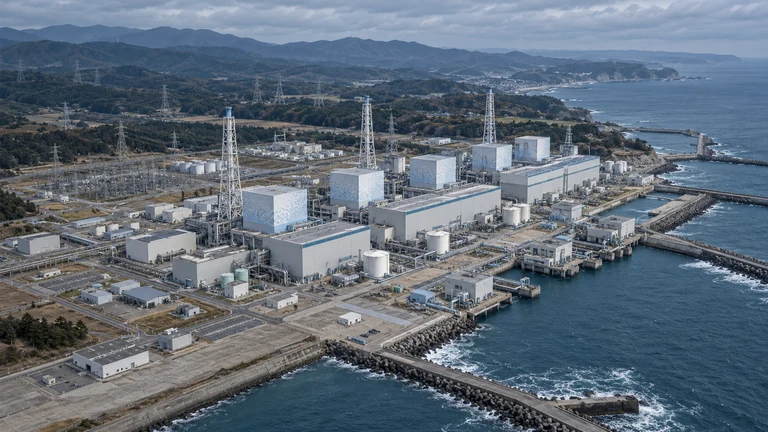
2011.03.11 · 15:27 / 15:35 JST
Waves reached Fukushima Daiichi at 15:27 and 15:35. Flooding damaged generators, electrical distribution and seawater systems. Multiple units lost power and cooling functions; surviving equipment and response time differed by unit.
Backups cannot fully protect one another if the same flood disables them together.
2011.03.11 → 15 · HOURS TO DAYS
Cooling carries heat from fuel into water and then out of the system. If that path cannot be maintained, water heats and evaporates. Without adequate replacement, the level falls and exposed fuel can overheat.
This cutaway shows the principle. Units 1–3 had different systems and accident timelines.
2011.03.11 → 15 · UNITS 1–3
Units 1–3 suffered severe fuel damage and melting. Radioactive releases and evacuation extended the disruption to people’s lives. Unit 4 was undergoing maintenance, with all its fuel in the spent fuel pool.
The core is the fuel region inside the reactor. Damage to Unit 4’s building does not mean a Unit 4 core meltdown.
Japan MOE · Accident sequence · IAEA · Accident report, Vol. 1
2011.03.12 / 14 / 15
Hot zirconium fuel cladding reacted with steam to produce hydrogen. Building explosions occurred at Unit 1 on 12 March, Unit 3 on 14 March and Unit 4 on 15 March. Hydrogen from Unit 3 is understood to have entered Unit 4 through shared vent connections.
Hydrogen reacting with oxygen is a chemical explosion, not an atomic-bomb-like nuclear detonation.
NRC · Fukushima lessons · Japan MOE · Accident sequence · IAEA · Accident report, Vol. 1
LESSONS · PREPARE IN LAYERS
Connect strong or long coastal shaking and official warnings to evacuation action. Protect diverse supplies of power, water and heat removal from a common hazard. Learn local evacuation routes and wait for official return guidance.
One wave ending, one barrier or one backup supply is not the end of preparedness.
Historical and accident sources checked 31 October 2026. Current decommissioning status and dose projections are outside this film’s scope.
A classroom floor can sit above sea level. If water covers that floor, the depth above the floor differs from the water’s elevation above sea level. Always mark where the ruler starts.
water: 5 m; ground: 2 m
Both elevations begin at the same reference sea level.
5 − 2 = 3 m
Three metres is water above this patch of ground, not a universal tsunami height.
No. Different ground elevations produce different local depths. For a real tsunami, follow local warnings and evacuation instructions; these pictures cannot determine safety.
Where the numbers come from: IGN. The illustration and worked model are made for this lesson; assumptions are stated above.
Interactive controls become available when the model loads. The explanation and data remain readable below.
A fictional debris-rich scene informed by observations of the 2011 Japan tsunami. Earthquake magnitude and local flow depth describe different quantities. Object release, paths and debris density are authored illustrations. NOAA debris transport · USGS field evidence
Isolate the force of still water on one side of a vertical wall. The animation adds visual motion; this calculation considers only the hydrostatic component.
Reproduce the calculationThis chapter controls flow depth above local ground. The diagram separates it from coastal wave height and runup.
Instituto Geográfico Nacional · Tsunami measurements · Japan Meteorological Agency · Tsunami questions
These depths are teaching choices, not official alert levels. The accounts describe possible mechanisms and past observations, not a universal collapse threshold.
Water reaches the lower part of a car. Even a modest depth can carry debris into objects and buildings.
Japan Meteorological Agency · Tsunami questions · NOAA / National Weather Service · About tsunamis
Doorways and the lower floor are immersed. Construction type matters: JMA describes partial damage to some wooden homes around this inundation depth.
JMA reports severe destruction of wooden homes around 2m of inundation in past cases, with large differences between structures and locations.
Japan Meteorological Agency · Tsunami questions · USACE HEC-RAS · Hydrostatic and momentum forces
A 3m water column reaches a notional storey height. Moving water, buoyancy, debris and erosion act together.
NOAA / National Weather Service · About tsunamis · USACE HEC-RAS · Hydrostatic and momentum forces
Much of the small house lies below the waterline. The same depth can have very different effects on different coasts.
NOAA Ocean Today · Tsunami debris transport · USGS · 2011 tsunami field observations
The selected water depth exceeds the height of the 8m house model. A taller building makes the vertical scale visible.
The selected depth approaches the top of the 24m building model. This is a fictional extreme-depth comparison, not a reconstructed event.
These are the complete assumptions behind the numerical readouts.
pbase = ρgD
F / b = ∫₀ᴰ ρgz dz = ½ρgD²
D is flow depth in metres; b is wall width. Assume constant density ρ = 1,025 kg/m³ and g = 9.81 m/s², a vertical wall extending through the full depth, still water on one side and a dry opposite side. Readouts subtract atmospheric pressure.
At D = 1m: p ≈ 10.06 kPa and F/b ≈ 5.03 kN/m. At 2m: the static force is ≈ 20.11 kN/m, four times larger. This is not the total loading on a real building: flow speed, impacts, buoyancy, erosion and water inside also matter.
Engineering Statics · Fluid statics · USACE HEC-RAS · Hydrostatic and momentum forces
A fictional flat street and generated artwork illustrate the mechanisms. Reference heights are chosen model dimensions: person 1.7m, car 1.5m, house 8m and taller building 24m. Vertical sizes use one scale, while horizontal placement is arranged for readability.
The 14s inflow/return and 56s depth journey are presentation clocks. They do not calculate a tsunami travel time, inundation distance, current velocity, building fragility, or a safe elevation. The buildings stay visible as scale references.
Strong or long shaking, a sudden sea-level change, or a loud ocean roar can be a natural warning. Move to high ground or inland when safe to do so, and follow local officials. Later waves can be larger; return when authorities say it is safe.
NOAA / National Weather Service · During a tsunami · Korea Meteorological Administration
Sources reviewed for this chapter on 25 October 2026. The physics readouts are reproducible teaching calculations; generated artwork supplies the atmosphere and object textures.